
Vailulu’u underwater volcano

Pago Pago, AMERICAN SAMOA — A team of specialists from the National Oceanic and Atmospheric Administration (NOAA) are heading to American Samoa with instruments to analyze the strength of the underwater volcano activities affecting Manu’a.
This followed a statement issued Tuesday evening by the...
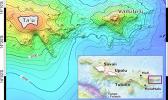
Pago Pago, AMERICAN SAMOA — The American Samoa Government has activated its Emergency Operations Center (EOC) in response to reports of underwater volcano activity reported by residents of Ofu and Fitiuta in Manu’a.
In a statement issued last night by the EOC indicated reports of the ground shaking...