sinking land in American Samoa
Greenbelt, MARYLAND — After the 8.1-magnitude earthquake in 2009 worsened land subsidence [sinking or settling] in American Samoa, NASA scientists introduced InSAR technology, revealing increased subsidence rates post-earthquake. This research underscores the need for accurate data in global...

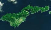
![Landsat image of American Samoa’s Tutuila Island, acquired on July 22, 2022, with the Operational Land Imager (OLI) on Landsat 8. [Credits: NASA Earth Observatory/ Lauren Dauphin] Landsat image of American Samoa’s Tutuila Island](https://www.samoanews.com/sites/default/files/styles/teaser/public/field/image/tutuila_oli_2022203_lrg_web.jpg?itok=q4R8BQwQ)