
NASA
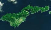
Greenbelt, MARYLAND — After the 8.1-magnitude earthquake in 2009 worsened land subsidence [sinking or settling] in American Samoa, NASA scientists introduced InSAR technology, revealing increased subsidence rates post-earthquake. This research underscores the need for accurate data in global...

Silicon Valley, CALIFORNIA — NASA invites video gamers and citizen scientists to embark on virtual ocean research expeditions to help map coral reefs around the world in an effort to better understand these threatened ecosystems.
During the past several years, researchers at NASA’s Ames Research...

There comes a time in every coronavirus (COVID-19) quarantiner’s life when they discover that they can no longer scroll through Tiger King memes or consider baking sourdough bread. And when that time comes, the National Oceanic and Atmospheric Administration’s Virtual Dives feature is here to...